The World Between Buildings (TPS Ep. 8)

Episode 8 begins a block of five short films on city life as it’s experienced outdoors, between buildings. Upcoming episodes focus on walkable and memorable streets, the importance of street trees, street-oriented architecture, and parks, greenways and blueways.
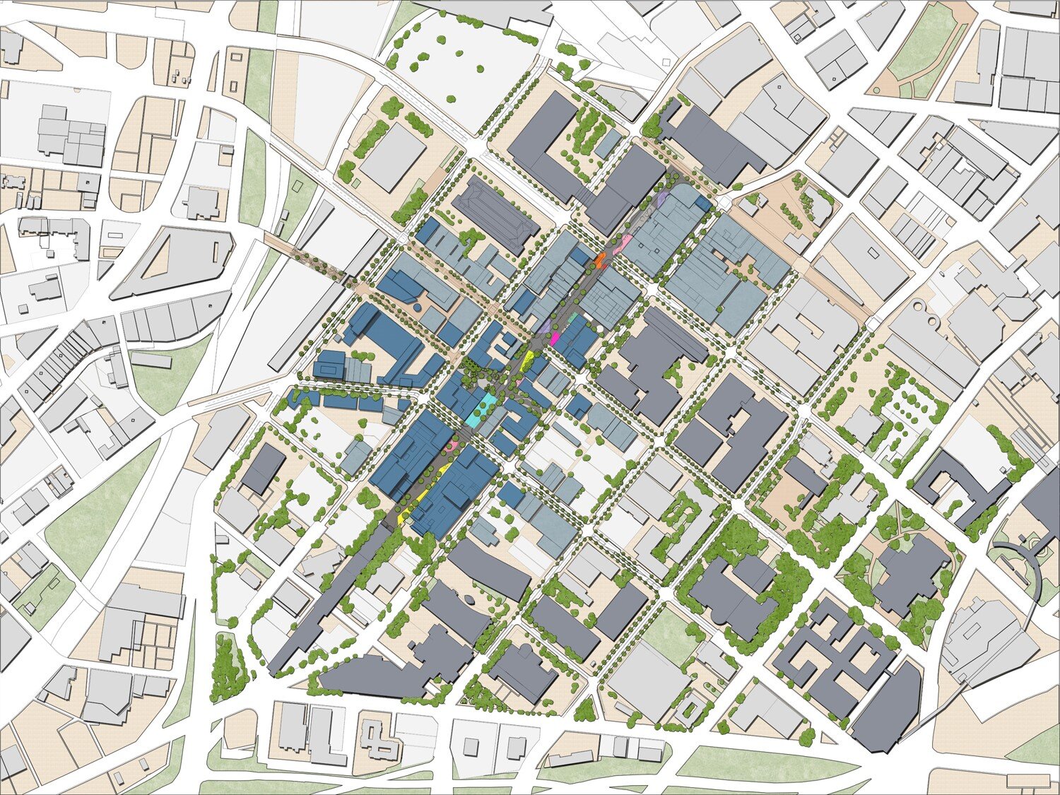
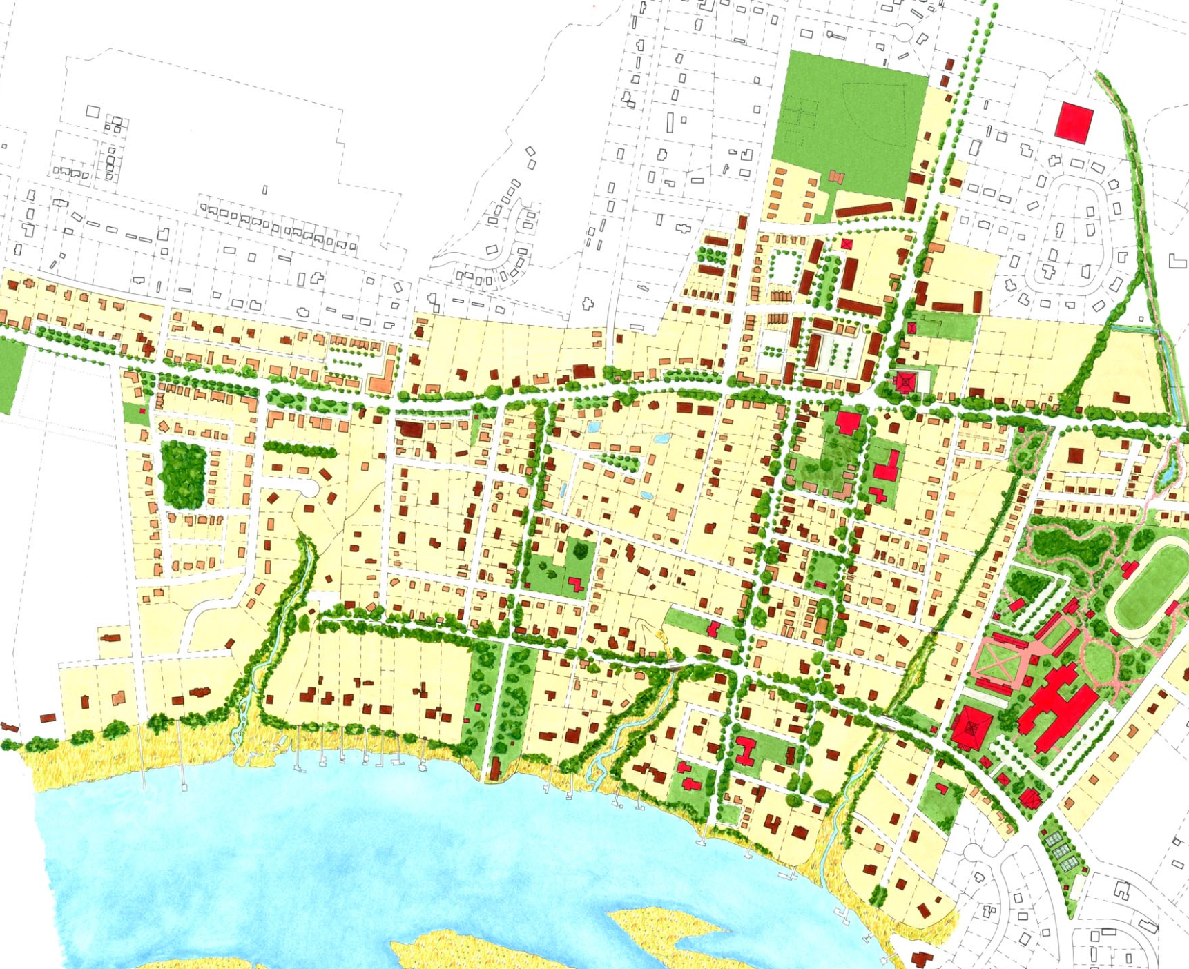
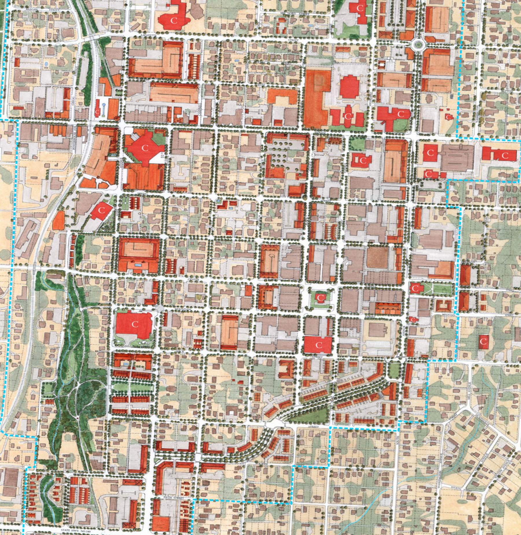
The "public realm" is where our first impressions of your whole city are formed. In this video, urban designer Victor Dover outlines how these spaces between...

The public realm

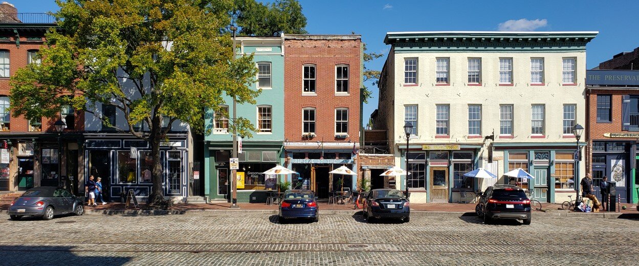
Towns and cities speak to us through their outdoor spaces—the public realm, the world between the buildings. Those public spaces, whether street or parks or squares or plazas, are composed, given their shape and focus, by the design and placement of buildings and the landscape. There’s usually a sense of enclosure and completeness where the public realm is strong. Sometimes the space is narrow, sometimes wide, at times intimate, at times opening up to and contrasting with long vistas.

Street-oriented architecture is a vital ingredient for a positive experience in the public realm.

Your city is a communications device. It’s sending you a message. Is it welcoming people?

Wide or narrow, as you move about the neighborhood day to day, the public realm is where you’re spending your time. And when that public realm is thoughtfully planned and designed, it sends you a message of confidence and comfort and neighborliness. It’s where memories are made, where friends can meet, where ideas are exchanged, where commerce and art and culture and civic life intersect.

Caveat: It could be sending everyone the wrong message.

Warning: Your public realm could be sending all the wrong signals

It’s easy, however, to get it all terribly backwards, and when the public realm is starved for attention and quality, it sends exactly the opposite message: that this is a place where nobody cares, a message of uncertainty. The public realm is where our impressions of the whole city or countryside are formed— for good or ill.

The public realm is just as important in rural places

Experiences

What experience is your neighborhood offering?

The public realm is crucial everywhere, but it’s especially so in cities that need to attract population and investors for revitalization, and in tourist destinations. Give people a good experience, and they’ll return, and help you build a stronger economy, a better tax base, and a creative culture.

If you want people to return, your public realm has to exude confidence. The design is crucial.

The public realm matters, so whether you’re a mayor or a real estate developer or just a taxpayer, it needs your attention. That’s #8 on my list of Town Planning Stuff Everyone Needs to Know. For more information, check out the Dover Kohl YouTube channel. —Victor

Mixing Land Uses = Convenient Daily Lives (TPS Ep. 7)

Burbage’s Grocery, in Charleston SC

Burbage’s Grocery, in Charleston SC

A big part of the convenience and functionality of traditional towns comes from their mix of land uses. Episode 7 of Town Planning Stuff Everyone Needs to Know, Mixing Land Uses,” reaches screens Monday, May 24 at 2pm. (Please share it, and subscribe to our YouTube channel to get notified about upcoming episodes. And, watch the episode for some cool new animations by Theresa Dover.)

Ever wonder why there's so much driving going on? What makes historic neighborhoods so popular? Watch this intro to the benefits of planning for mixed land u...

Instead of pushing the needs of daily life farther apart from one another—as became common in the suburban zoning experiment after World War II—the time-tested way of building a town is to deliberately bring a range of human activities closer together. That way, you can find many of the things you need right in your neighborhood, within walking distance.

For example, you might be able to walk from your home to a corner store or a café without having to drive there-- and without having to search for a parking space! Our client and collaborator, traditional neighborhood innovator Vince Graham, argues that “mixity” is more important than density when sizing up the impacts of development.

Vince Graham, founder of Newpoint and I’On, with one of the places we’ve designed together, seen in Ep. 7

Vince Graham, founder of Newpoint and I’On, with one of the places we’ve designed together, seen in Ep. 7

Just a little bit of mixed use brings many benefits:

Shorter Trips, More Workable Transit, Less Carbon

Some trips out on the regional road network get shortened. Others get eliminated, captured within the neighborhood. And still others become feasible for walking, biking or transit. All of that helps manage regional traffic. Plus, with those shorter trips you’ll lower everyone’s carbon footprint.

Flexibility, adaptability and historic preservation in Fells Point, Baltimore

Flexibility, adaptability and historic preservation in Fells Point, Baltimore

Flexibility, Historic Preservation

But that’s not all. Mixed land uses allow for organic, economic choices and change over time, letting the market have more sway over the mix. That, in turn, also supports the adaptive re-use of beloved historic buildings, extending their lifetime.

Balance, and Getting to Know the Neighbors

Live/Work combinations— also known as zero commute housing— and mixed land uses allow for a better jobs/housing balance, which can be key to a municipality’s sustainable tax base, lowering the costs for households, businesses and government. And above all, in a mixed-use neighborhood you’re simply more likely to get to know your neighbors and support local businesses. Psychologist Susan Pinker reports that studies definitively show what she calls The Village Effect: face-to-face interactions are crucial for a sense of contentment and for longevity, especially in an era when high tech devices tend to isolate us. She writes: "Neglecting to keep in close contact with people who are important to you is at least as dangerous to your health as a pack-­a-­day cigarette habit, hypertension or obesity."

The Italian island of Sardinia has more than six times as many centenarians as the mainland and ten times as many as North America. Why? According to psychologist Susan Pinker, it's not a sunny disposition or a low-fat, gluten-free diet that keeps the islanders healthy -- it's their emphasis on close personal relationships and face-to-face interactions.

For all these reasons and more, mixed-use neighborhoods are incredibly popular with both households and employers, attracting people and attracting jobs. That’s why Mixed Land Uses are #7 on my list of Town Planning Stuff Everyone Needs to Know. For more information, check out doverkohl.com, or read the now-classic book The New Urbanism by Peter Katz (McGraw-Hill, 1993).

—Victor

Downtown: Shared by All (TPS Ep. 6)

Episode 6 of “Town Planning Stuff Everyone Needs to Know” is about downtowns, and it posts 5/18/2020 on our YouTube channel.

Have you ever stopped to think about which neighborhood is the most important one in your city?

The thing about a downtown is, it’s everybody’s. No matter where you live in a town, if your town’s downtown neighborhood is doing well you probably have a sense of shared ownership and pride in that place. 

When a town grows to the size of several adjoining neighborhoods, it will start to need (and deserve) some things that most individual neighborhoods can’t support all by themselves, like a larger central gathering place, or a Main Street, and seats for the most important shared civic institutions, like City Hall. In healthy cities these are almost always found among workplaces and housing and lodging and places to shop and eat in the downtown neighborhood or center.

When they’re allowed to, downtowns naturally evolve to become mixed-use, mixed-income, multi-modal precincts. Jane Jacobs put it this way:

“The [downtown], and indeed as many of its internal parts as possible, must serve more than one primary function; preferably more than two. These must insure the presence of people who go outdoors on different schedules and are in the place for different purposes, but who are able to use many facilities in common.”

“The Need for Mixed Primary Uses,” from The Death and Life of Great American Cities

Variety, planned on purpose, like you mean it

The wide variety in neighborhoods and building types within the core of a traditional city ultimately provides opportunities for people of all ages, backgrounds, cultures and income levels to live and work together. In contrast to suburban development, which generally offers only the single-family detached home, traditional cities offer a range of housing options, including single-family homes on smaller lots, rowhouses, garden apartments, the loft conversions that are transforming many former industrial districts, and, in some cases, midrise and highrise options for the people Frank Lloyd Wright once called “cliff dwellers.” Each of these housing types is located within mixed-use blocks, allowing for residents to meet their daily needs and conveniences in a dynamic urban neighborhood. As centers of commerce and trade, downtowns also provide an incredible variety of employment opportunities. With a city’s commercial and residential life follows cultural facilities and retail establishments. Young professionals, CEOs, students, doctors, government officials, shopkeepers, retirees, and families alike can all find their place in the heart of the city, due to the incredible diversity of jobs, housing types, cultural amenities, and (hopefully) varied means of transportation. This incredible range of land uses, housing types, employment, and income levels within a traditional urban fabric provides the freedom of choice, a privilege not afforded to residents of mono-functional suburbs.

Renaissance underway (but there is a catch)

Downtowns, even the ones that fell into decline 40 or 50 years ago, are naturally set up to once again become places where people want to be. But they need tender loving care. You must not force suburban zoning or parking requirements or street designs on your downtown, and if that’s happened already, your city is not alone, but it can join the ranks of the cities that have begun reversing the process.

The good news is, Americans have rediscovered their downtowns, in small villages, medium-sized towns, and big cities. According to Walkable Urbanism author Christopher Leinberger, half our downtowns are already revitalizing, and the other half soon will be. Your downtown is the most important neighborhood in your city, shared by all. And that’s #6 on my list of the Town Planning Stuff Everyone Should Know.

For more information, subscribe to the Dover Kohl YouTube channel, and also read up on the Main Street program of the National Trust for Historic Preservation. —Victor

P.S. Next week: Episode 7, Mixed Land Uses

Every Neighborhood Should Have These Five Things

This one’s all about neighborhoods: Episode 5 of Town Planning Stuff Everyone Needs to Know reached screens Monday, May 11, 2020 via social media and our YouTube channel, and it includes some striking animations by Alex England, Kenneth Garcia, and Pablo Dueñas.

Neighborhoods are the basic building block of a city or town.

In 1929, Clarence Perry documented what he called “The Neighborhood Unit.” His classic diagram remains useful; it’s been updated several times since, including in the early 1990s by Gary Greenan and Lizz Plater-Zyberk for AIA Graphic Standards, and again in 2007 for Doug Farr’s book Sustainable Urbanism.

Clarence Perry’s “Neighborhood Unit.”

Clarence Perry’s “Neighborhood Unit.”

When you have one neighborhood standing alone among the farms or in the woods or the wilderness, that’s a village. When growth leads to several of these neighborhoods positioned tightly together, you get a town, and, with even more neighborhoods, a city. In this way, small towns and big cities like Paris or New York or Washington are all cities made of neighborhoods.

Neighborhoods: the fundamental unit of city building.

Neighborhoods: the fundamental unit of city building.

The five crucial ingredients

Neighborhoods vary a lot, but they have five basic characteristics. We keep these in mind when planning a new neighborhood or when carefully updating or restoring an existing one.

Compact, complete, connected, convivial.

Compact, complete, connected, convivial.

First, a proper traditional neighborhood has an identifiable center & edge. You know when you’ve arrived at the heart of a neighborhood; large or small, it almost always has a deliberate, consequential public space, shared by all. You will typically find a square or plaza, and a noteworthy civic building or landmark (and in the best examples, some locally-serving commerce). Edges, on the other hand, vary greatly. While historically a fortified town might have had a wall for protection, that has thankfully evolved to more inclusive and welcoming physical identifiers. The boundaries between neighborhoods might simply take the form of a mixed-use main street shared by several adjoining neighborhoods, forming a “seam” instead of a seal. Or the edge can be a greenbelt of parkland, forest or farmland, or a water body, or a transit or greenway/trail corridor, or some other feature. All that being said, centers are arguably much more important to the neighbors’ well-being than the edges; the centers are where the bonds of community are most firmly formed.

Second, the neighborhood is limited in size, about five minutes’ walk from center to edge. That’s an easy distance to navigate without driving. It’s also an amount of territory that is easily mentally mapped, committed to memory in great detail, and in an area this size people come to know many of their neighbors. Parents in traditional neighborhoods tend to allow their children greater freedom to roam for these reasons. Five minutes’ walk results in a radius of about a quarter of a mile, but that’s a rough measurement only; neighborhoods are almost never circular! Perry’s neighborhood unit envisioned idealized neighborhoods at a size of about 160 acres, but in practical application we find traditional neighborhoods range from about 40 acres to about 300 acres. Larger sites are designed as multiple neighborhoods. Although there are many ways their edges are defined physically, real neighborhoods don’t extend endlessly across the horizon.

Next, it has a mix of land uses & building types & housing types and prices. That variety allows for some of life’s basic daily needs to be satisfied within the neighborhood. (More on this coming up in Episode 7, on mixed land uses.) An old rule of thumb says, if you can buy a quart of milk within 5 minutes walk, that’s a more livable neighborhood. That’s also a neighborhood where you’re more likely to walk or bike, burning calories instead of fossil fuels. We don’t use the term “neighborhood”to describe vast, standalone precincts of a single land use, like tract house subdivisions, apartment complexes, office parks, or shopping centers. Variety in the housing types and sizes welcomes a wider range of households and income levels, making it possible to blend generations, improve inclusiveness, and to avoid socially harmful concentrations of poverty.

Fourth, the neighborhood should also have an integrated network of walkable streets. Making the streets connected, beautiful and walkable are all key to fostering a healthy culture of physical activity, making public transit viable, creating great addresses that add value to real estate, and more. (Episode 8, on the public realm, and Episode 9, on walkable street design, will cover this in more detail.)

Last, the neighborhood should have some of the best sites reserved for civic purposes, like public buildings, places of worship, parks, squares, and gathering places. These sites are the ones which are lent significance by the artfully composed geometry of the neighborhood plan itself; for example, a civic building is lent prominence by positioning it at the end of a street vista or facing a public square, communicating the importance of the shared institution inside it to the society that built the neighborhood. Public buildings and civic gathering places are crucial anchors that lend certainty in an unpredictable world, precisely because they are more permanent than the private houses or everyday workplaces— so these sites should be identified, set aside and protected from private development right from the beginning.

Neighborhoods: They’re fundamental, and they’re #5 on my list of #townplanningstuff everyone needs to know. —Victor

"Connect the Dots" virtual lecture draws huge audience

On May 4, 2020, Victor Dover delivered a “virtual lecture” for the Civic Conversations series, hosted by the Pensacola News-Journal and the Studer Community Institute. Quint Studer introduced Victor as “the Michael Jordan of urban planning” at the start of this extraordinary event, streamed live for an estimated 6000 viewers. The talk features an in-depth discussion of what makes housing expensive, and what to do about it, including how the costs of housing and transportation must be considered as a composite number, and examples of innovation from around the United States. The event concluded with a live Zoom Q&A moderated by Lisa Nellessen-Savage, executive editor of the PNJ.

TPS Ep. 4, Visualizing Change

The fourth episode in Town Planning Stuff Everyone Needs to Know is about before-and-after thinking. To do planning and urban design you have to take a hard look at a place to see what’s there, and then imagine in your mind’s eye what it should be, in the future. And then, you have to draw it, somehow, and show it to others, and ask, “Is this what you envision, too?”

This is a visual process, it’s not just planning by the numbers. You have to make your visions visual to really communicate them. Advertisers have long known this; they love to depict the new and improved as compared to the old. Think of the TV commercials showing the dirty t-shirt “before” it’s washed in the new detergent, and how great it looks “after” their product gets used or their advice gets followed! Professionals and policymakers have long needed to apply that kind of communication more often to the big decisions about our built environment.

Historically, some of the most influential thinkers about design understood this well. Landscape architect Humphrey Repton painted garden scenes on two layers of canvas, gluing a hinged top layer depicting “before” conditions over a bottom layer depicting his proposal, so he could show the impact of changes with the turn of a canvas flap. John Nolen, the first American to refer to himself as a professional city planner, titled his book “New Towns for Old,” capturing the before-and-after essence of his visions.

Way back in the 1980s, Joe Kohl, Erick Valle and I saw a TV news report about surgeons who were using crude video imagery to show trauma patients how their faces might look after reconstructive surgery. Before, and After. We thought, what if we could do the same thing to help heal the disfigured American city? That few seconds of television changed the course of our lives. We launched our “Image Network” company— the outfit that over time became our town planning practice— with an emphasis on visualization. We got pretty good at it. Those early contracts to produce electronic simulations and communication tools thrust us in front of the whole range of influencers who really decide what happens in our designed environment, from mayors, planners, architects, developers, and engineers, to preservationists, environmental advocates, economists, housing experts, retail experts, and community activists. We quickly got exposed to how all these folks think, and had to learn to translate among them.

But in those first years we gradually realized, and had to confront, a few key things. One was that most decisionmakers, including architectural designers, are terribly unskilled at envisioning how their abstract plans and elevations will actually turn out once built in the real world, such as how big or small the buildings would be, how the streets would feel, and how their new construction fits (or doesn’t) with its context. Another finding: Once we created effective simulations that showed their projects in the cold light of day, warts and all, they often weren’t sure what to do about it to fix the flaws. We felt the need to transition to leading the design and planning process, rather than just reacting to it as illustrators, after all the big decisions had already been made by someone else. Influential teachers like Elizabeth Plater-Zyberk, Mark Schimmenti, Geoff Ferrell and Jaime Correa taught us about urbanism, and we set out to rebuild our practice around the principles they introduced into our studio.

Today, whenever we propose changes to a street scene or a neighborhood, we use drawings and computer imagery to show how the place you know could be transformed over time, new and improved into a better place. We urge planners to think of plans less like a static map and more like a movie, which changes as you go along. It’s about thinking through change over time, whether the changes are gradual or dramatic and disruptive. This helps community leaders and investors make better choices.

Visualizing Change Before it Occurs: It’s #4 on my list of town planning stuff everyone needs to know. New episodes post each week; please share them, subscribe to the Dover Kohl YouTube channel, and let me know what you think. —Victor

TPS Episodes 3 & 13: Designing in Public (In Person and Online)

A new two-episode block of Town Planning Stuff Everyone Needs to Know is now on our YouTube channel. These are about engaging the public in planning and urban design--  even now, during the Great Confinement of COVID-19. Episode 3, “Designing in Public,” was filmed just before our successful charrette for the plan for downtown Panama City last year. Given the astounding events since, we decided to revamp and post Episode 13, “Online Engagement,” months early, to discuss ways of keeping public participation and collaboration going even while we are all practicing social distancing to limit the spread of the coronavirus. Here’s the gist:

#3: Designing in Public

Once upon a time, it might have seemed normal for a few insiders to get together in some smoke-filled room to figure out the future plan for the town. But today, an interactive, citizen-driven process for city planning is essential. Changes in the built environment can be controversial, to say the least. Education and a shared sense of authorship are essential to creating consensus. We therefore need to get the planning process out of the back rooms at powerful agencies and out into the sunshine, designing in public, where everyone who’s interested is invited to participate right alongside the authorities and technicians and experts. That’s because the best plan is made by many hands.

One good approach is a public design charrette, usually about a week long. It’s a combination of on-location storefront design studio and interactive town meetings. It’s like an old-time barnraising, except instead of erecting a barn, we’re getting the community together for a compressed period of time to build a plan. Early on in the week, that includes a major public hands-on planning session, in which small groups each tackle the map and debate alternative futures. Then, each group presents to the others, to compare their big ideas. As the charrette week unfolds, the designers and planners work to make the many plans into one, testing scenarios and producing illustrations of the ideas. The doors are open all week, so Citizen Planners are invited into the studio to offer feedback. Then, at the end of the week, we typically gather everyone again for a Work in Progress Presentation, when we’ll put the draft work up on a big screen and ask, “Is this what you meant?”

Designing in Public is more fun, and quicker, and more effective. That’s #3 on my list of Town Planning Stuff everyone needs to know. For more information, check out the info from the National Charrette Institute.

#13: Don’t Stop Public Engagement – Just Move it Online

As a followup to Episode 3, I recorded #13 in March 2020, as we entered the era of coronavirus. A lot of us have been working from home, keeping our distance in one way, while maybe, growing closer in others, via our digital screens. But we don’t have to stop public participation in planning decisions, or stop designing collaboratively & interactively. We just need, for now, to use the amazing array of digital tools already available to us, and move the process online.

For instance, in the past month we’ve staged two virtual charrettes, combining quick online collaboration, surveys, polls, building and comparing scenarios, videoconferencing, and webcasting. It’s a little like the rapid prototyping-and-feedback process that industry has been evolving for decades—but now we’re relying on it for city planning.

Parts of our office team have been telecommuting for many years now, so we’re used to this way of working. With collaborations underway with teammates and clients five or six different time zones apart at any given moment, in our practice we’ve grown accustomed to working with a lot of the cool digital tools. But now the occasion of the COVID-19 outbreak has pushed us to combine those tools anew, just one way we’re keeping our projects going.

Understanding the Limits

There are certainly limitations to online communication, so there will always be a place for in-person events once we can get back together. One of those limitations I call “the negative tendency of the internet.” We’ve all seen how not looking folks in the eye when you’re saying something or writing something is tempting to the less wholesome parts of human nature—so snarky comments, pile-ons and trolling can start to accumulate.

The antidotes to that tendency toward cynicism or negativity aren’t perfect, but they’re pretty straightforward. First, we brief our participants on the constructive criticism rules for our online brainstorming space. One good rule is, “Build up ideas, don’t just tear others’ ideas down.” We ask participants to tell us what you do like and tell us your solutions, not just what you see as problems. Next, we give them lots of information, posting resources on the website about the project at hand, and refer back to those resources as questions arise. Third, there are plenty of nooks and crannies on the Internet for anonymity. But this is not one of them. So we make it a requirement that for town planning projects, people must post and comment and webcast under their real name. Everybody has to introduce themselves, just like they would in the City Council chambers or when passing a microphone around in those traditional public meetings at the school cafeteria. Last, we respond fast, but once. We answer the questions and clear up misinformation, but don’t get into a never-ending back-and-forth.

A Crucial Moment

Right now, getting together in civic engagement and thinking about your community’s future can be a reprieve from the cable news and TV shows. Let’s make the most of it. Let’s use this time to educate, and re-ask the question, what do we want our communities to be?

There’s a lot of innovation now underway in this space, and I’m sure we’ve barely scratched the surface. Future generations may look back and see this decade as a turning point in the history of city planning, a time when we made it all more relevant and more accessible.

Sometime soon, eventually, when we get the all-clear to return to in-person public meetings and to go back out into the all-important public realm, we’ll need to be extra-ready to move town planning projects forward and create the places where people want to be. We’ll have a local and global economy to rebuild, in new and better and more inclusive ways. The worlds of real estate and infrastructure and city management will need to be better and smarter, too. We’ll need strategies for pulling together, and for executing on small and sensible incremental-growth projects that add up to real progress.

So we won’t stop envisioning, planning and collaborating... we’ll just be doing more of it online. To learn more about how we’re using “virtual charrettes,” videoconferencing, and other kinds of digital collaboration, subscribe to the Dover-Kohl YouTube channel.  --Victor

Ep. 2, The Importance of Design

The second episode of Town Planning Stuff Everyone Needs to Know is now on the Dover-Kohl YouTube channel. This short new installment introduces a crucial topic: why we can’t overestimate the importance of design, versus mere policy planning.

If you only know the land use or the density or the setbacks or the required number of parking spaces, you won’t know whether a development is good for the neighborhood or bad. In the video, we compare two places. The density? The lot size? The land use? All are exactly the same. But I’ll bet you’d prefer to live in one of them, and not the other.

The design is even more crucial than the land use. The character of a street scene comes from the building-to-street relationships, the landscape, the shape and quality of the public spaces, and the texture and proportions of the architecture. If your little lot or parcel presents a blank wall or a parking lot as its face toward the public realm, that will make everybody less likely to walk or bike or use transit—so small decisions have regional implications.

Design matters. That’s #2 on my list of town planning stuff everyone needs to know. Let us know what you think of the episode, watch for another one next week, and please subscribe to the Dover Kohl channel on YouTube. —Victor

Town Planning Stuff, Ep. 1: The Benefit of Planning

We’ve now posted Episode 1 of Town Planning Stuff Everyone Needs to Know on the Dover-Kohl YouTube channel. Subscribe & watch the whole playlist; new episodes are being posted weekly.

The benefit of planning

Ever wonder whether city planning meetings and zoning hearings are a colossal waste of time? They aren’t, as long as your town isn’t just going through the motions. Ask: What do you want your neighborhood to be like? Every community should set out to create its ideal. That means not just talking about it, or writing policies, but making maps, designing the future.

Towns, like people, have to choose what they want to be when they grow up. Every place people love has resulted from some level of planning. Those places didn’t come from the Easter Bunny or Santa Claus. If they’re nice places to be, they probably haven’t always been that way. People drew lines on maps, deciding what kind of neighborhood this should be.

All the little decisions matter. So give some of your time to help move planning along in your town.

Planning brings benefits. And that’s #1 on my list of Town Planning Stuff everyone needs to know.

—Victor

New Video Series: Town Planning Stuff Everyone Needs to Know

Greetings friends and colleagues! Today, we’re introducing “Town Planning Stuff Everyone Needs to Know,” a new playlist on our Dover-Kohl YouTube channel. Please subscribe to the channel! Over a series of super-short videos, we’re going to take a journey into big ideas, about cities, that should matter to everyone, not just the professionals or experts. Watch these and you’ll be a ready citizen planner.

We’ll look at the root purposes of city planning, the importance of design, and designing in public—and, along the way, we’ll visit topics like architecture, street design, downtown revitalization, historic preservation, green building, lowering your neighborhood’s carbon footprint, the public health impacts of the built environment, and setting  your town up for walking, biking, and transit— plus some other surprise topics!

One target audience is the time-stressed, easily-distracted local elected official! So the videos are very quick, bite-size intros to best practices and key breakthroughs. Tell your mayor or councilperson to take a look, even if it’s just for one or two minutes at a time.

greenscreen.jpg

We’ve mounted an at-the-office and at-home team effort to create the first season of episodes, with Kenneth García, Pablo Dueñas and my daughter Theresa Lee helping film, animate and edit sequences, and my son Thomas composing and performing original background music. So, welcome to Town Planning Stuff Everyone Needs to Know! Share the clips, and let me know what you think.

—Victor Dover