
Lee Highway Visioning Study
The Lee Highway corridor is a major east-west thoroughfare spanning the length of Arlington County from East Falls Church to Rosslyn, leading into Washington DC. It is a major commuter corridor, and serves as a primary commercial destination for the northern half of the County. The general development pattern, characterized by mid to late 20th century low-rise commercial development with prominent surface parking lots and limited pedestrian and bicycle infrastructure, is typical of many the commercial corridors of its era found throughout the country.
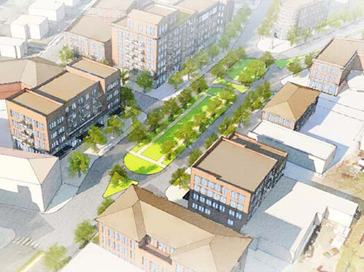
A consultant team led by Dover, Kohl & Partners was selected to work with Arlington County and the Lee Highway Alliance to illustrate a community vision for future land use and urban design. A four-day public planning charrette was the centerpiece of the visioning process; community workshops provided opportunities for group brainstorming and input. The Visioning Study report documents the charrette process and input received, summarizing ideas and concepts that resulted from the community conversation. The report identifies key ingredients of the future vision for Lee Highway, describing a corridor with mixed-use centers of varying scales, improved streetscapes that support all modes (walking, biking, driving, and transit), a diverse mix of housing types, quality public gathering spaces, retention of local businesses and unique neighborhoods. Plans and renderings apply vision principles to sample areas, demonstrating ‘what if’ hypothetical development and public space improvements, and exploring possibilities for the potential form and appearance of future built conditions.

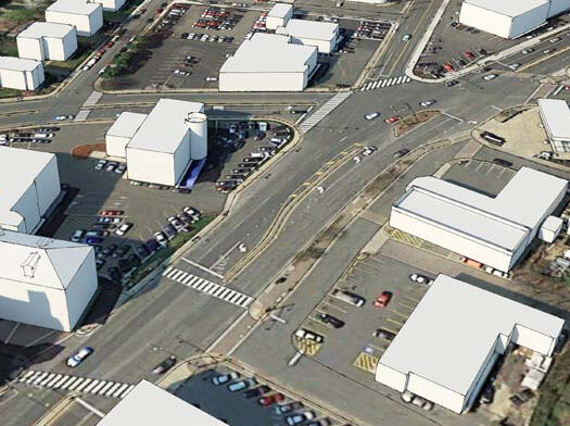
Below: Cherrydale and the 5-points intersection aerial view.