A simple way to get smiles on the sidewalk

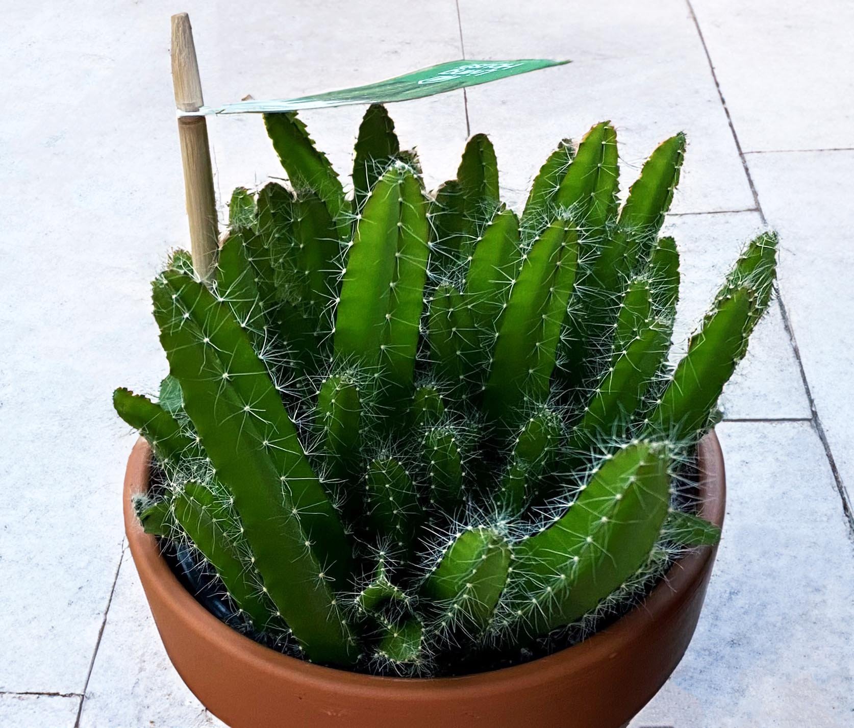
Often, I find myself at lunchtime walking the three blocks from my office to our “urban” Whole Foods to try to eat healthy. [Urban = no parking lots out front, with doors on the sidewalk]. Despite the heat in Miami in July, there was nothing unusual. There were plenty of others walking to or from the same place. But the other day I saw this cactus as I entered the store that was calling my name. I’m not one to buy plants, as anyone who knows me can attest. So I bought it along with food to go.

As I walked back to the office, with my brown paper bag in one hand and the small plant in the other, suddenly I noticed everyone looking at me and then the plant and then back at me with a smile, both men and women, sometimes with a big smile and sometimes a grin. At first, I felt really uncomfortable, but after the first block I was okay with it. It made me feel good seeing people who normally don’t smile doing so while walking in their daily routine. Go give it a try and see what response you get. If this simple plant generated that many smiles, next time I will try a bouquet!

—Joe Kohl

Olmsted Network shines national spotlight on "Lake Wales Envisioned"

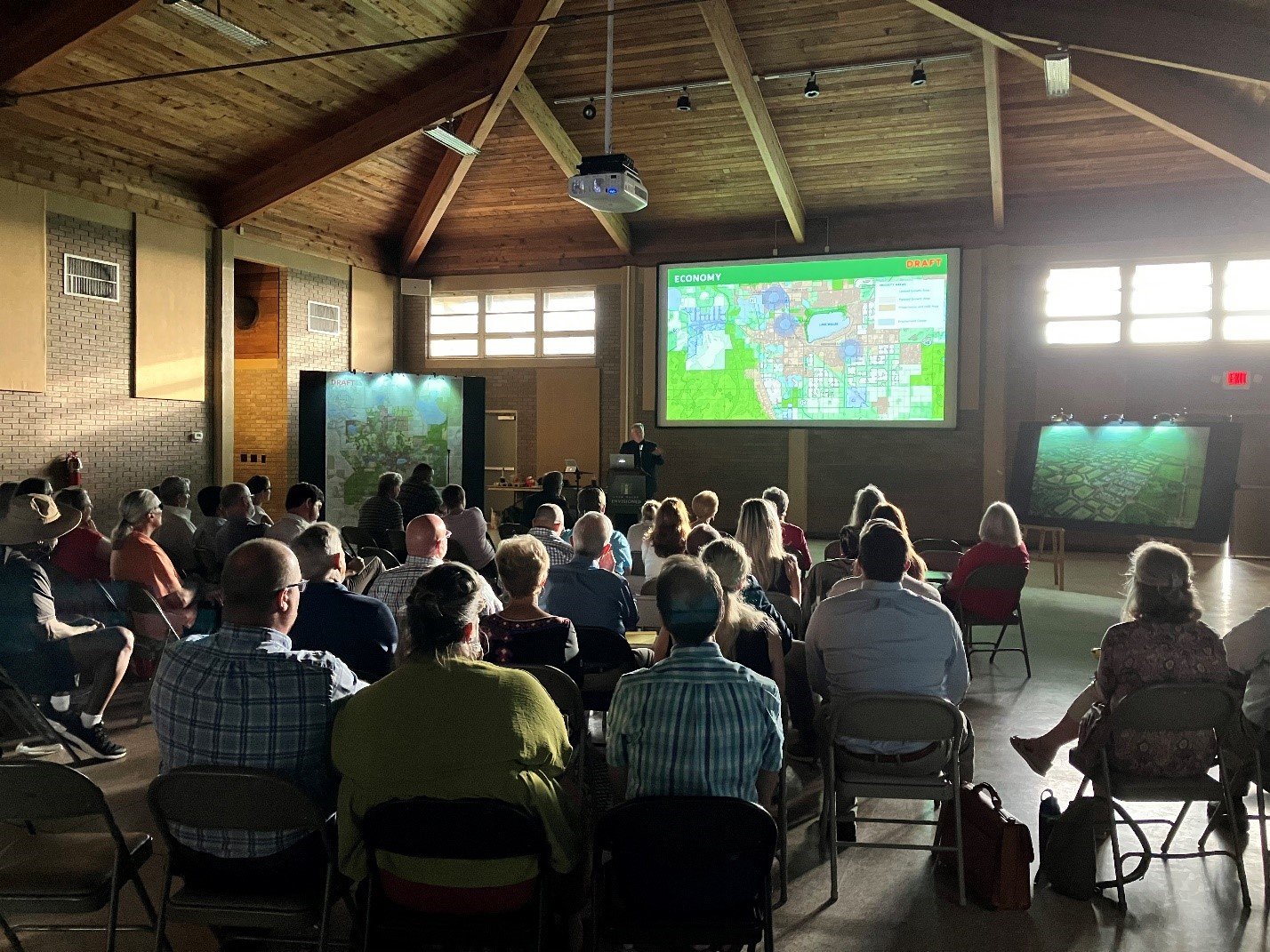
Last year, Lake Wales scored two headlines on the same day: One lauded LW for reconnecting to its Olmsted roots (for the #LakeWalesConnected downtown plan). The other screamed that "one of the most imperiled Olmsted legacy landscapes faces new threats" (from ill-conceived sprawl). The followup #LakeWalesEnvisioned initiative is about getting the city’s big picture for future growth (and its form) back on track. Yesterday, I got to introduce #LakeWalesEnvisioned to the national audience of the Olmsted Network as part of their "Conversations with Olmsted" series! My short presentation begins at about 9:00 min in the video. —Victor

DK&P presents Lake Wales a vision for the future

Last week, Lake Wales, FL residents heard a compelling call to action on the community’s future. Lake Wales Envisioned is a momentous effort aimed at curbing sprawl along the rapidly developing Lake Wales Ridge in central Florida due to a collapsing citrus industry and continued development pressures. Warch the recording of the presentation:

Recording of the Community Update presentation

Residents were presented with an alternative vision for this special place; a vision that turned a very possible near future of endless cul-de-sacs, cars, garages, and asphalt into a lovable landscape of over 25,000 acres of newly proposed conservation lands, parks and open space, greenways, trails and community gardens interspersed with walkable neighborhoods connected to one another where residents have a chance to build relationships and live fulfilled lives.

The famous Olmsted Brothers planning firm advanced improvement plans for Lake Wales and nearby Bok Tower Gardens, and created a “city in a garden” for the enjoyment of future generations. Now is the time to make a determined effort to save the Lake Wales Ridge from rampant sprawl.

A variety of local, state, and national partners are supporting the City in this effort, underscoring the importance of the Lake Wales Envisioned plan to the city and region. Learn more at lakewalesenvisioned.com.

Victor Dover to Vero Beach: "You can have the town you want"

In the off-peak times, all that extra asphalt is a clear invitation to drive faster

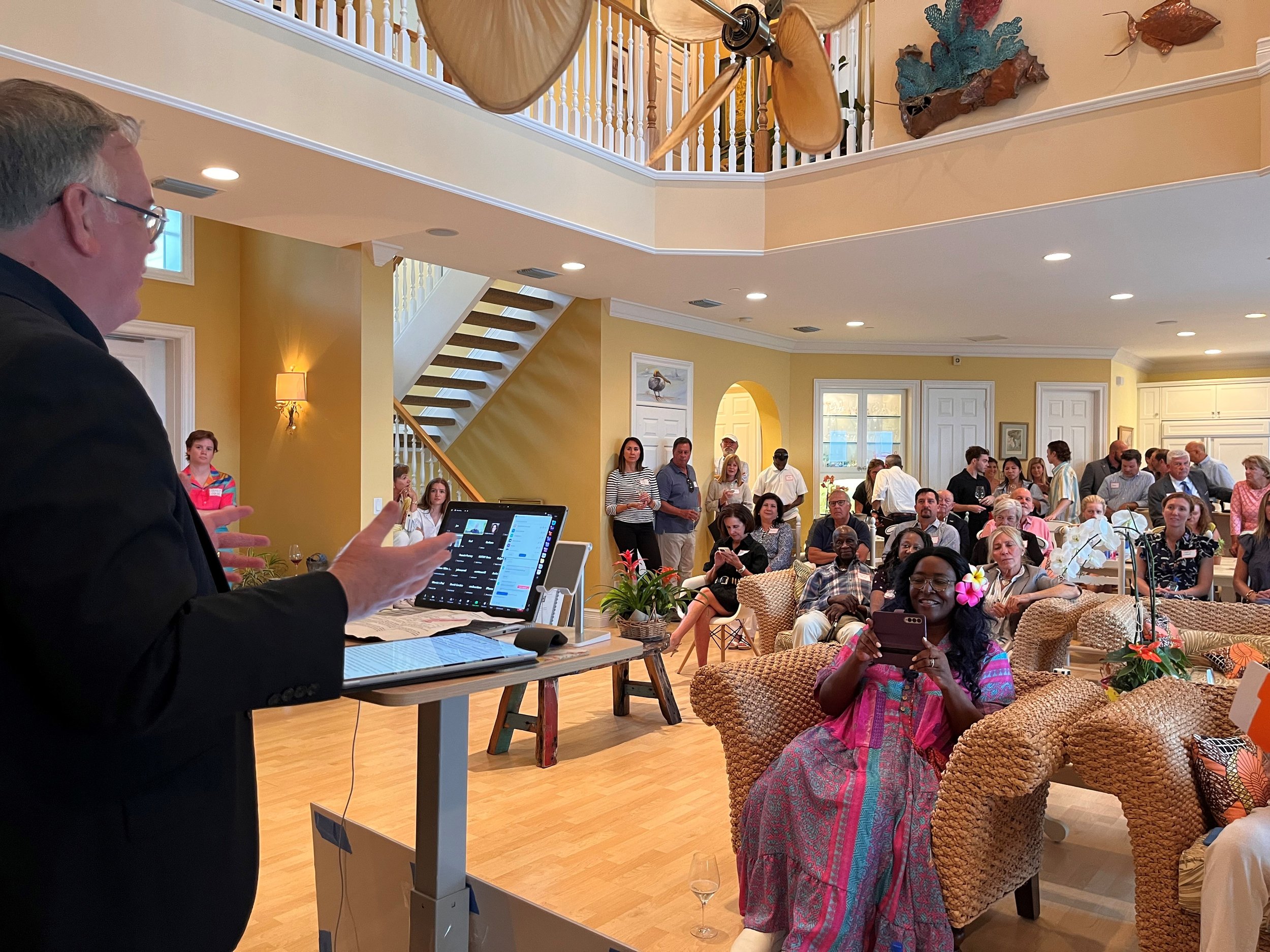
On July 19, 2023, Victor Dover addressed 200 Vero Beach citizens in person and online as part of the “Let’s Talk Vero” events series. The City of Vero Beach and Florida DOT are considering what to do about its notorious “Twin Pairs” combo of wide, fast, one-way roads. Here are Victor’s remarks:

BIG PICTURE: YOU CAN HAVE A BETTER AND BETTER TOWN

Thank you for having us in Vero Beach. I always say, we have the best job in the whole world, traveling and helping communities decide what they want to be when they grow up, grappling with growth and change amid a changing world. It is gratifying work.

Like Vero, most communities have a confidence problem: Is the change making things better or worse?

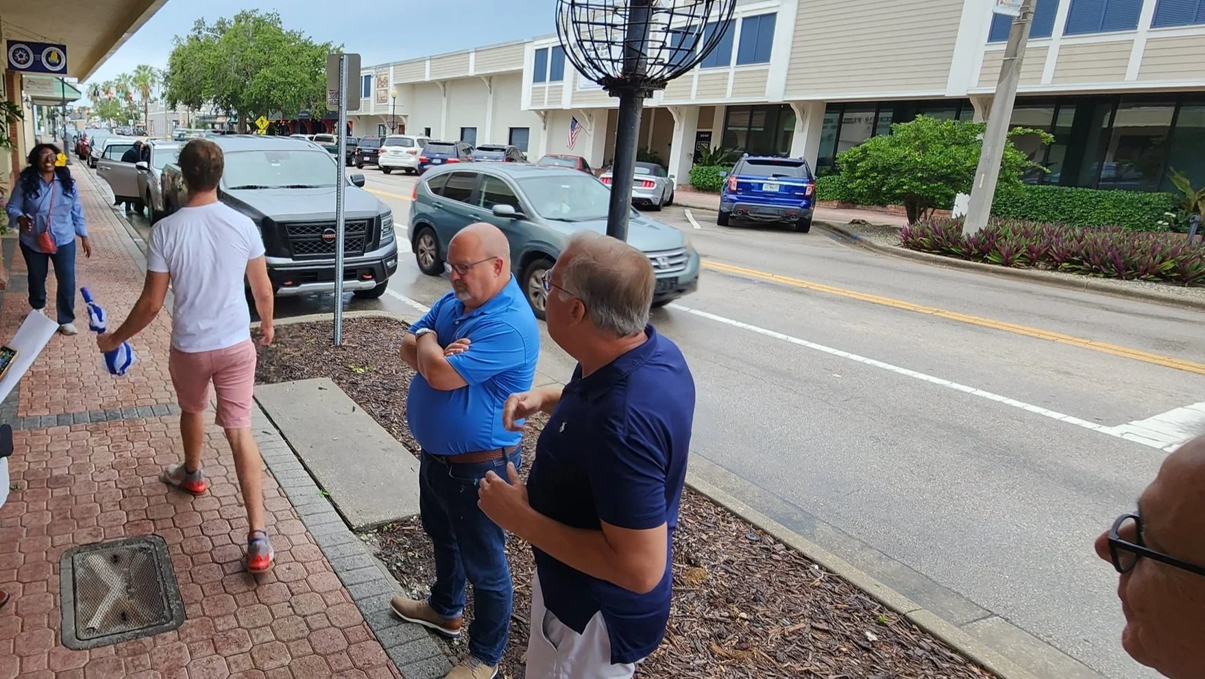
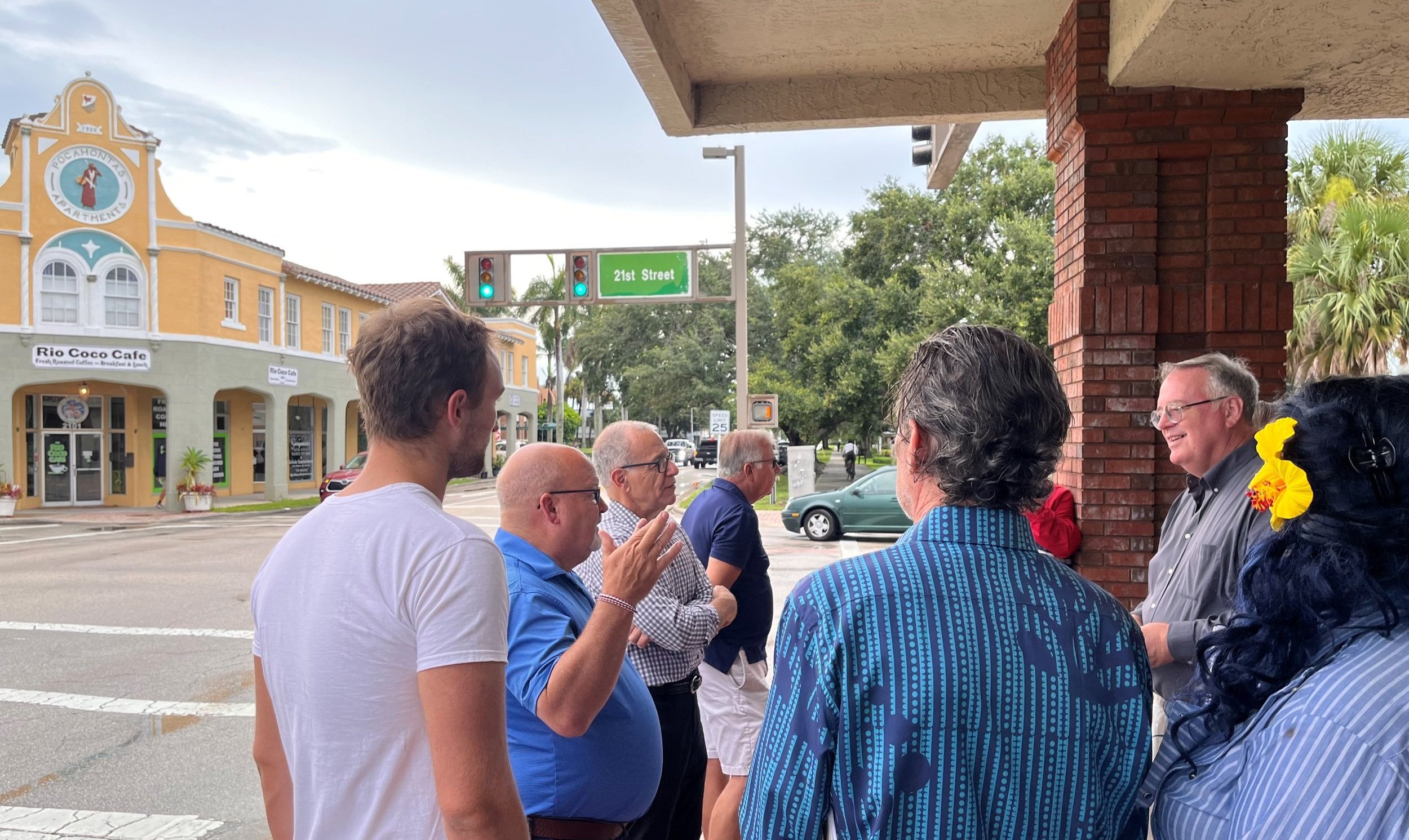
Walking tour with Vero Beach citizens in advance of the Let’s Talk Vero event

Think of the places you’ve visited that you loved. How did they get that way? They were designed (and redesigned) that way. Great towns don’t occur by accident, or come from Santa Claus or the Easter Bunny. They come from putting in the work, building consensus, drawing lines on maps, trying things, doing more of what works, adjusting what needs adjusting…  Cities are great, collectively produced, collaborative, never-finished works of art.

Good news: You can have the town you want, if you’ll give yourselves permission to have it and work together to get it. In particular, it stands out that your most important shared spaces in the center of town—the downtown neighborhood, the twin pair corridors—are not yet evolved to the quality and vibrance that reflects your mostly-beautiful, affluent, well-educated, well-traveled community… at least not yet.

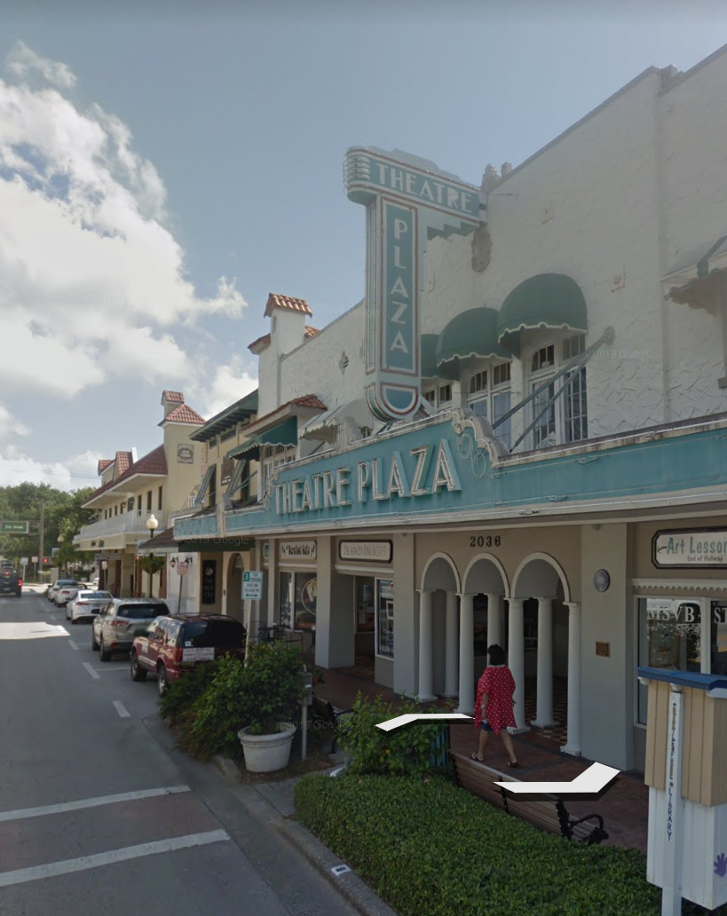
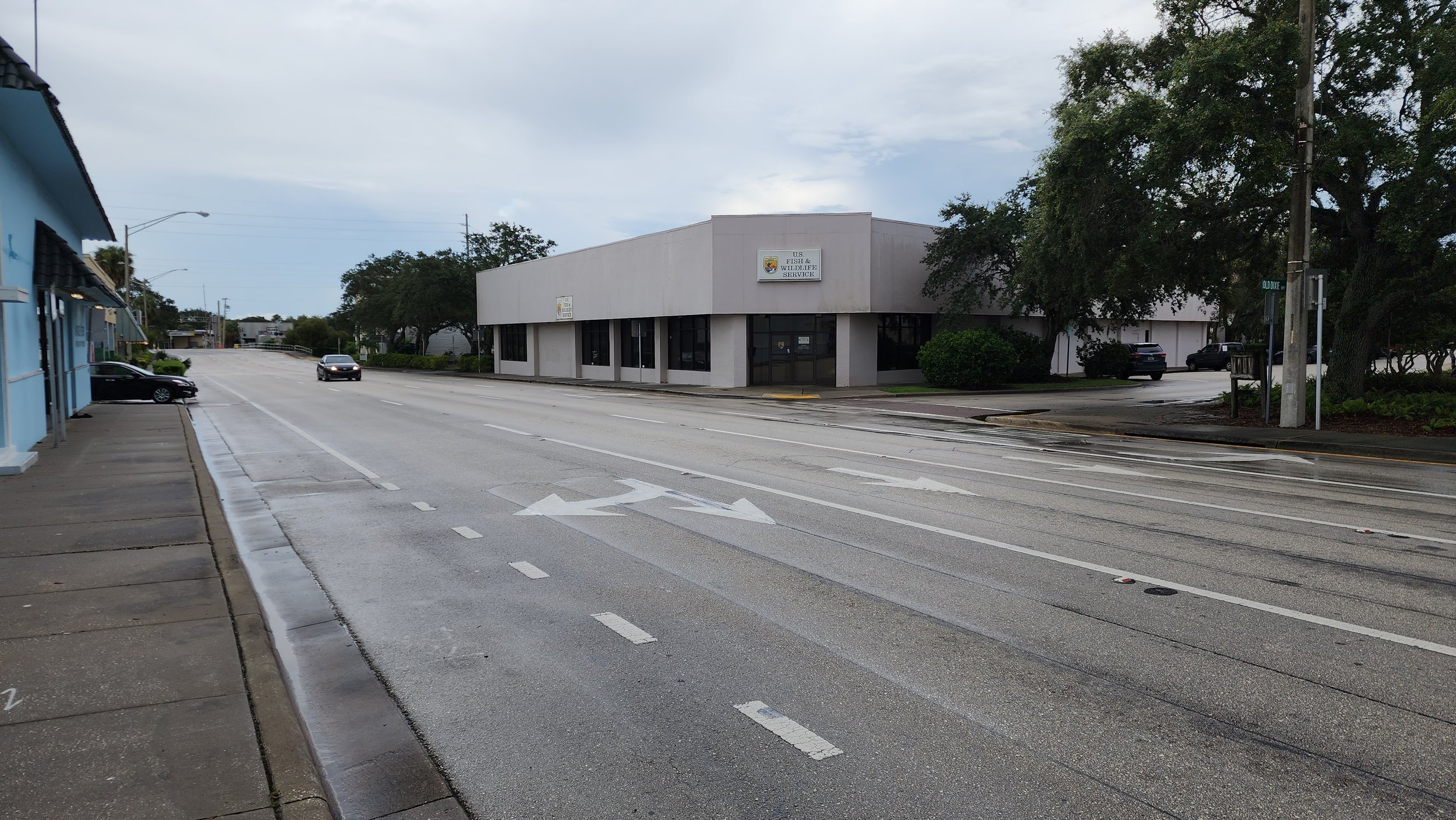
Google street view shows that Vero’s pioneers used unapologetically urban, street-oriented architecture, conveying their confidence in the future.

I look at the historic buildings and I can see that your founding families and early visionaries were convinced of this potential. From the days when the streets were just dirt or just had Model Ts rambling along them, those early mixed-use, Main Street buildings had this confident, upright architecture and a clear building-to-street relationship.

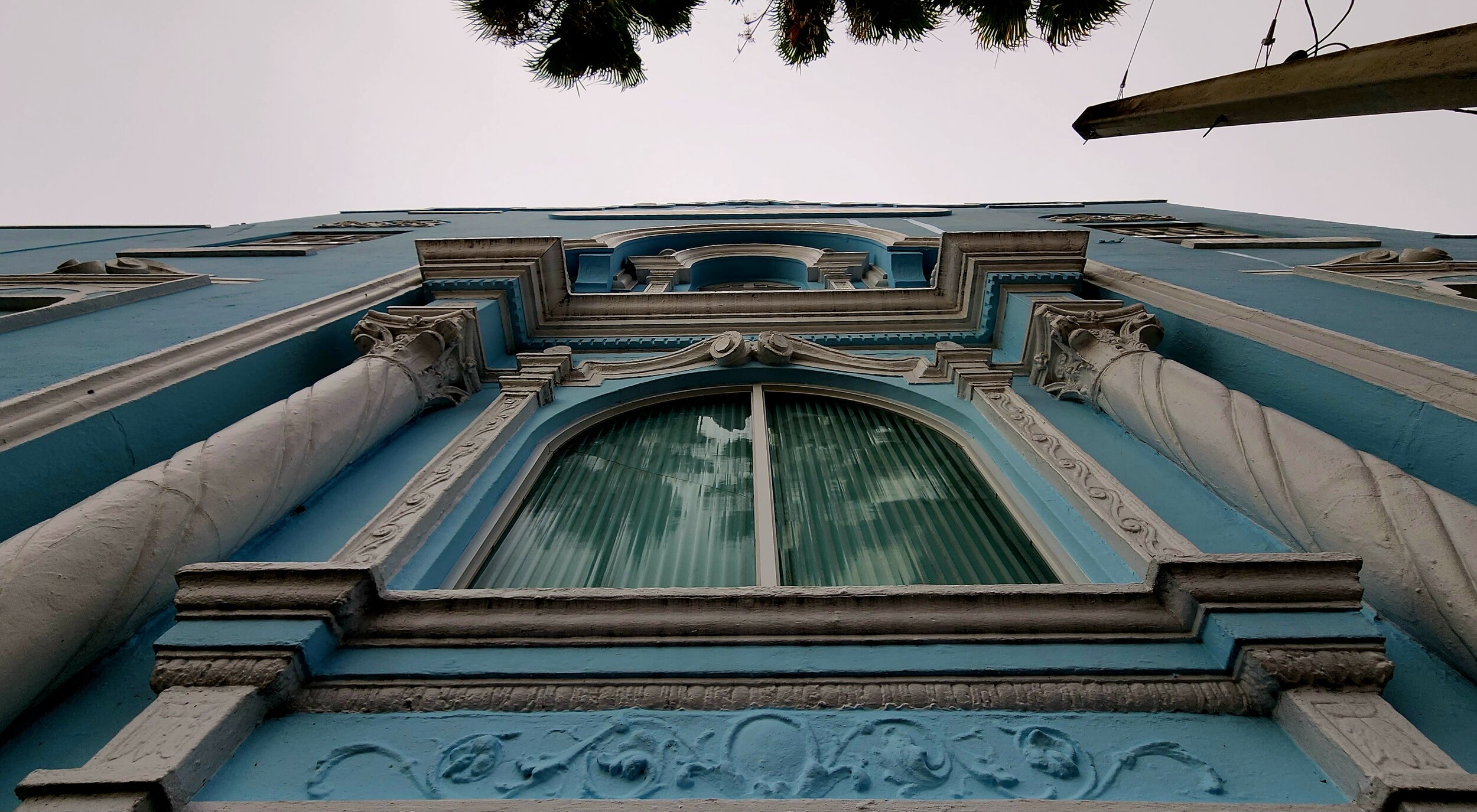
When in Vero Beach, look up: The early architecture was meant to shape a proud human habitat. It was meant to be experienced at walking pace.

I’ve learned you’re undertaking a downtown revitalization plan, and that is great to hear. It’s not necessary to figure out absolutely everything in advance, and it will not be a tool that has to boast 100% consensus to be useful. But it will be a great aid in building confidence. Where do great places come from? They come from you. They come from starter conversations like the ones you’re having in Let’s Talk Vero.


Blight is an often inevitable— but usually reversible— effect of America’s binge of road-widening and traffic-accelerating.

STREETS MATTER

Now, let me ask you: What’s the largest thing you own? Your city’s streets.

The subtitle of the book John Massengale and I wrote about Street Design is, “the secret to great cities and towns.” I became convinced that good street design is probably the one feature a city can least afford to get wrong, and yet it is the feature most often gotten wrong.

Tour group in downtown Vero Beach

It’s basically this: Streets are where we form our most lasting impressions of a place. It’s not just the buildings, although those matter a lot; it’s the spaces between buildings, like the parks and squares and streets (and especially the streets) that are the public rooms of the city. In Vero, your streets are your commons. Owned by everybody. Or perhaps nobody. I don’t mean to be too harsh, but in some of those streets one can see the Tragedy of the Commons playing out. They aren’t conveying the kind of confidence such corridors can and should convey.

I urge you: Don’t take the attitude that the streets are someone else’s problem. They are not just “transportation facilities.” They’re addresses.

When they work as they should-- at least in the part of the city where you care about economic vitality, about property value, about eight year olds, about eighty year olds, about small and large businesses, about public health and safety, and about environmental fitness—which is to say, every part of a beloved city—the streets should be designed as human habitats, places where people want to be.

Some of the things that need to be there include street trees, low-stress spaces for walking and biking, and good building-to-street relationships. You don’t have to be a wildlife biologist to size up these habitats-for-cars. You don’t have to be an anthropologist or sociologist to know that our species is repelled from places that have blank walls facing streets or have high-speed motoring with all its noise and violence, but we’re attracted to places with shade and artfulness and visual interest and, importantly, evidence that other people are around.

THE NEIGHBORHOOD PLAN

The great thing about coordinating your efforts on street design within a larger core-area master plan is that, since everything is connected to everything else, you can make informed decisions. As we walked yesterday I asked: What are this neighborhood’s basic economic and humanistic reasons for being? These change over time. Fort Pierce was once the place the cattle drives brought protein to market, to load on the barges. Now it’s evolving to 21st Century uses. Vero has been a citrus town, which is of course changing, and a holiday town for visitors and seasonal residents. Within that evolving mix, what’s going to be the core area’s root function?

I think as you ponder that, the street design decisions, the architecture decisions, the zoning decisions will all then become much easier. You might want to open up the options for more housing and more lodging in the core area, to bring more customers within walking distance of that great coffee shop, for instance, so it’ll have the customers it needs to be there when you, as a local fulltime resident, want to go there.

NEW TIMES, NEW RULEBOOKS

Last, I want to talk about something new, something you all need to know when working with your friendly neighborhood FDOT (Florida Department of Transportation). It’s this: the rules have changed. Over decades, it always seemed like the DOT was always saying NO to the things local government leaders wanted, like safer streets and saner, right-sized, appropriate-speed streets. They would say, Madam Councilmember or Mister Mayor, we can’t do that, our one-size-fits-all rulebook doesn’t allow it.

First: Think back to the Happy Motoring era, the 1950s or 1960s, when many of us were born, and we didn’t know it but in those postwar years we were living in the last phase of the Golden Age of the Automobile. There was this forceful, national, propaganda-fed idea that “wider, faster roads [were] better roads.” That plugged into everything: budgets, manuals, high-octane federal subsidies; that was the era of “what’s good for General Motors is good for America” and it was a public works juggernaut. Traffic flow was… everything. Many other community ideals—like safety and strong property values, to name a couple—were de-prioritized. And you can understand it; who wouldn’t want to flow? Road widening, highway-building, and rebuilding, and re-re-building was the order of the day, and the motoring public was okay with huge amounts of the national treasury being spent on it. Old gasoline ads said, “Drive more, it gets cheaper by the mile.”

The innovations like cloverleaf interchanges and the fads, like one-way pairs, came fast. Yours is not the only town that got the one-way-pairs-and-road-widening treatment. It was seen as a way to squeeze a little more flow out of the intersections during the peak seconds of the peak hour. And, it seemed like a good way to spend all that federal money raining down on the states, even if we didn’t really have the traffic numbers to justify such wide streets “yet.” (You still don’t.)

Ironically, speeding everything up was exactly the opposite of making it safer and more efficient.

These roads became less safe and less hospitable because, outside the peak hour, all that extra asphalt provides a clear invitation to higher speeds. Remember, humans tend not to drive the posted speed, but rather the speed that feels comfortable given all the visual clues coming into your eyeballs through the windshield—and so if it looks like the Indianapolis Speedway, we drive as if we’re on the Indianapolis Speedway.

In turned out that in many cases the one-way pairs were undercutting their own on-paper efficiency, too, because if you have to drive twice as far and go out of your way and drive through five or six intersections instead of two, you’re doubling up the vehicle-miles-traveled per person and, while you’re getting turned around to get to your destination, you’re in my lane, when I’m in such a hurry, for whatever reason. You’re messing with my flow! No happy motoring for me.

Note: Fads fade, and many towns have been gradually undoing their one-way pairs and repurposing unneeded lanes, rebalancing flow against the whole range of other issues.

Now, back to the manuals.

The many consequences of the road-building binge include a terrible safety record, especially in the relatively new settlements of the Sunbelt. The biannual report, called Dangerous by Design, shows Florida every time as the champion state… at killing pedestrians. And of course, it’s not just people walking and biking getting killed, it’s the victims of car-on-car violence as well. We’re at the point where we’re killing 40,000 persons a year in our mean streets, and it’s a major public safety crisis. A leading cause of death among those under 25, for one thing. And where are more of those deaths and injuries occurring than anywhere else? Florida.

So a few years ago, embarrassed by the latest headlines on Dangerous by Design, the state Secretary of Transportation said, let’s fix it. He challenged his department to find a way out of the number one Death Machine status. He ordered the FDOT to rework all its rulebooks--  and they’ve done it. More info here. ­­­­­­­­­­­­­­­­­­

They now have permission to say yes to things they used to dismiss, like safer design speeds and better lane geometries and all the features that aid safety. So remember this: You can get familiar with the new rules, and bring the District 4 FDOT engineers along with you on your search for better street designs. That way when they come around to do their resurfacing projects every 25 years or so, you can work with them to settle on designs that aren’t just resurfacings but meaningful redesigns.

The new rulebooks can be your superpower. For the nerds like me who might want to Google this and get into the tech of it all, search for FDOT FDM (Florida Design Manual) and “context classifications.” To make a long story short, it means, they no longer have to follow one-size-fits-all--  so they don’t have to treat a core downtown like it’s out in the distant sprawl strip or I-95.

I’ll conclude with one important admonition:

You need to do your best to arrive at local consensus first, and then re-engage FDOT. The Districts have been burned before, moving forward on the road diets and lane repurposings that the manuals now allow and even encourage, only to have the local folks reverse themselves and back out. So have some sympathy for your DOT officials, and have the conversation now.

Just having the conversation will bend the trend! So congratulations on what you’re doing with Let’s Talk Vero.

Missoula awarded $25 Million Grant for Downtown Missoula Plan Projects

The City of Missoula was awarded a $25M RAISE Grant for safety, access, and mobility projects recommended by the Downtown Missoula Plan co-authored by Dover, Kohl & Partners.

“This is a huge accomplishment for both Missoula and Dover, Kohl & Partners!” said Linda K. McCarthy, Executive Director of the Downtown Missoula Partnership.

The funding for infrastructure projects will allow Missoula to adapt its downtown area to fit the changing needs of the community. On the Higgins Avenue corridor, a four- to three-lane conversion will separate bicyclists and motor vehicles. Front and Main Streets will be changed to two-way streets to address safety and circulation issues in the downtown area. The project will fund riverfront trail access from Front and Main and widen the trail. Additionally, an ADA ramp will increase accessibility from the Higgins Bridge to Caras Park.

New Video: Bruce Stephenson on Olmsted, Nolen, and Lake Wales

Distinguished scholar Bruce Stephenson, PhD is a Professor of Environmental Studies at Rollins College. A city planner by training, Dr. Stephenson is an expert on the life and work of John Nolen, the landscape architect who was the first American to call himself a professional city planner. Nolen, in turn, was the top student of Frederick Law Olmsted, Jr., designer of Mountain Lake, Bok Tower Gardens and the 1930 Lake Wales city plan for planting street trees and improving the town. Dr. Stephenson recently gave a lecture at Bok Tower Gardens in which he described the connections between Olmsted, Nolen, Lake Wales, and the current planning efforts of Lake Wales Connected and Lake Wales Envisioned, led by DK&P. We invited Bruce to go through his presentation for the growing Lake Wales Envisioned YouTube video library, and asked him some new questions. Highlights:

"...[The juxtaposition of Burnham's buildings and Olmsted's grounds and central park at the World's Columbian Exposition 1893] "became the vision for the American city, showing how to meld nature and urbanism."

 ..."Nolen in his first speech would even go on to say that the future, what Aristotle called The Good Life, is this: Can our consciousness, our ability to see the common good, match our private interests?"

 ..."Like Olmsted Sr., Nolen studied landscape paintings as the doorway to his practice of landscape architecture. "[The takeaway from the Mona Lisa] is not her smile, it's the background, nature in motion: the belief that if we could understand how nature moved, we could understand how the world works and become closer to God-- a radical idea at the time. Da Vinci's lesson was 'follow nature, then your imagination'..."

 ..."Nolen's chief concern [after writing the biography of Frederick Law Olmsted] was to take Olmsted's plans and finish them.  That's what Dover Kohl is working on today [in Lake Wales], taking Olmsted plans and bringing them to fruition."

 ..."The Olmsted/Nolen vision was that the best places in nature are to be preserved and enjoyed."  39:34

 ..."Today our goal in Winter Park is to become more like Lake Wales" [making the Genius Preserve more like Pinewood and Bok's Sanctuary] 40:00

 ..."The work in Lake Wales Connected, this downtown revitalization plan, takes that same idea of connection that John Nolen had in all his plans, and Frederick Law Olmsted Jr., had in all his plans, and bringing it back to life."

 ..."When you look at the opportunities for defining the future of Florida, here it is, right along this Ridge [as Nolen observed a hundred years ago]. This is the challenge that Lake Wales has embraced: How do we take the natural, the rural, and the urban landscape together, and synergize them, to create a great community? The next steps will be difficult and challenging, but you have a wonderful set of principles to follow."  42:45

 "...Every time Nolen did a project, he would have a series of examples, historic exemplars. History does not lie; it gives us these principles. How you apply them now is the big test. But we all like human scale, we all like coherent architecture, we all like nature....What the end product is, if you are going to be truly connected, is when a developer comes into Lake Wales, he or she should expect that question: What are you going to do to make the pedestrian realm good, and how are you going to adapt [the principles]?" 44:11

 "...You want people to walk in Lake Wales and feel good. That can be done. The models are there, the principles are there. It's going to take an educational process." 46:05

 "...Olmsted was a genius. He wasn't a psychologist, but he called [walking in parks] "unconscious re-creation." He saw the cities as places of commercialism, but you needed to as he called it "unbend your mind" [with a twenty-minute walk in the scenery of one of his parks.] That's what Lake Wales has: If you walk through Bok Sanctuary for fifteen minutes, you're not the same person." 46:50

 "...I have two key points for the future of Lake Wales. One is the uniqueness of the landscape. Use native landscape, and bring it from the Ridge right into the center of town. Two is [to use] Bok Sanctuary, the design of that landscape, that crafted scenery; the Olmsteds designed it so as you move through the Sanctuary is almost like you're moving through a play or a movie, from one scene to the next, and along the way you're getting an increasing sense of beauty until you reach a prime space... I would do the same thing for Lake Wales, where there is a series of scenes, and I’m imagining the prime space would be downtown…and through the design of the neighborhoods and the parks and the connections you make a sense of scenery that is highlighted by the town center, like we saw in Nolen’s plan for Mariemont.” 48:42

 “…[Explaining how valuable Baldwin Park has become] The message to the developer is, if you build this way [the walkable, livable neighborhood], people will come. You could come to Lake Wales and have a real experience, it’s not going to be of a subdivision but of a neighborhood, connected to other neighborhoods.” 51:20

 “…One hundred years ago, one out of every three trips was by foot, one was by transit, and one was by car… We’ve lost that balance we had in Nolen’s time. We ought to have a mindset of creating communities of neighborhoods, of balance. The key is neighborhoods have to be walkable.” 53:15

 “…In Orlando, having neighborhoods and walkable places is so rare that on Halloween, every parent in Orlando drops their kid off in Baldwin Park, and the population quadruples. Having neighborhoods where kids can freely go trick or treating is as important as moving traffic at XX mph.” 54:19

 “…Lake Wales is important because they’re realizing the future is at hand. We can only expand so much. If Lake Wales fifty years from now is going to be competitive, and valuable, you want to grow those values over that time period… When Olmsted designed Central Park, he applied a fifty-year timeframe, knowing it would take that long for the trees to grow in. If you want to set a fifty-year vision, you can’t operate like it’s 1985. In 1985, the number one [real estate] amenity was a golf course. [Today] the number one amenity is a bike trail.” 55:20

 “…I saw Lake Wales Envisioned would be, as an opportunity for my students to see evolution of the planning practice, based on Olmsted plans and principles, amazing. It is a wonderful opportunity to see the past and the future melding.” 58:44

Planning for Resiliency as the 2023 Atlantic Hurricane Season Begins

Damage from back-to-back category 5 hurricanes in Cruz Bay, St. John, U.S. Virgin Islands

While the 2023 Atlantic Hurricane Season is just around the corner, planning for resiliency is a year-round effort. Identifying how our communities could be better planned to withstand the impacts of a future of stronger storms and how better neighborhood design can support a more dignified recovery process in both the short- and long-term, has never been more important. 

Recently our team has had the privilege of working with the City of Panama City, FL as it has made continuous progress in its recovery from Cat 5 Hurricane Michael in 2018 which uprooted 80% of its urban tree canopy and damaged or destroyed 90% of the city’s buildings. Working with the City, we were charged with charting a course forward that would help the city rebuild in a resilient way that celebrates its relationship with the coast and improves quality of life for all. Focusing originally on drafting the Strategic Vision for Downtown and its Waterfront, DK&P worked closely with community members to identify a common goal of breathing new life into the Downtown core with updates to the zoning code, a redesign of the city’s main street, Harrison Avenue, with a curbless, pedestrian-oriented, tree lined streetscape and central plaza, as well as supporting further revitalization of vacant and underutilized sites. Our team then took on the task of bringing this effort to the surrounding neighborhoods of Millville, Glenwood, and St. Andrews in an effort to ensure that recovery resources could be shared equitably across the city. Find out more about the continuing recovery effort in Panama City here: rebuildpc.org

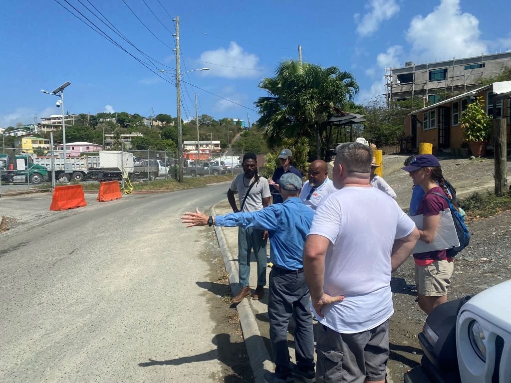
Next month, DK&P will be part of a team led by Horsley Witten Group working with non-profit leader Love City Strong and the community of Cruz Bay on the island of St. John in the U.S. Virgin Islands to assist in the ongoing recovery journey from the two back-to-back Cat 5 hurricanes of Maria and Irma in 2017. Building on its previous charrette successes in Charlotte Amalie on St. Thomas, the DK&P team will facilitate a public charrette June 11th – 16th that will continue to center the wisdom of local residents from a long history of living with hurricanes and identify key strategies to be implemented at the building, block, and neighborhood scales to allow the community to be better prepared for the next storm. Visit lovecitystrongvi.org to learn more.

Touring Cruz Bay, St. John, U.S. Virgin Islands 

Touring Cruz Bay, St. John, U.S. Virgin Islands 

Work in Progress: Warren Park – Northwest Arkansas Newest Mixed-Use Neighborhood

An integrated stormwater canal within the North neighborhood of Warren Park. Dover, Kohl & Partners, 2022

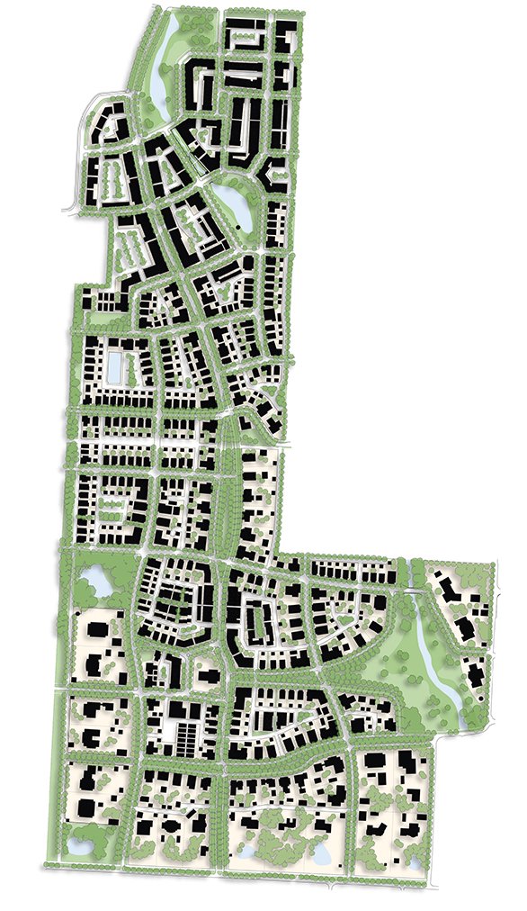
Warren Park Illustrative Plan

A subtle slough wandering through the hay bales, a vast and dancing meadow of wildflowers, and a perfectly pale blue Arkansas midday sky met the Dover, Kohl & Partners team as they first started laying out the future for 197 acres of Northwest Arkansas pastureland. The Warren Family farm’s natural charms and connectivity to Rogers, Bentonville, and the Razorback Greenway together make for fertile grounds in planning the next great NWA community.

The Dover, Kohl & Partners-led design is essentially two, five-minute neighborhoods large – one North and one South – taking advantage of the existing topography and canopy to create accessible urbanism for a wide variety of households and businesses interlinked through public space.  This “Village of Gardens” is inspired by the many great historic American planned neighborhoods of the early 20th Century and their European originations. Places like Mariemont in Ohio and Forest Hills Gardens in New York with their view-framing street deflections and grand public greens or the classic architecture of the Cotswolds and Bath that inspired them in turn. These examples create the foundation for settling a town in the rolling foothills of the Ozarks and are just as relevant to Bentonville as they are Bruges with a strong organization around site context and architectural regionalism.

View from the boutique hotel balcony toward the canal biergarten and event space

Both neighborhoods of Warren Park are centered around public spaces framed with fine-grained building fabric. The northern neighborhood features the more active and commercial areas of the mixed-use program bikeable via the Razorback Greenway and a separated cycletrack. This new Main Street runs a block away and parallel to the existing shallow stream now activated and compressed with canal-front restaurants and boutique hotel rooms while expanded on either end with floodable, passive stormwater parks. The larger of the two stormwater parks lies uphill and when dry serves as a commons for the nearby community center and crescent units on its perimeter.

Grand estate lots are set near the southern neighborhood edges in Warren Park, coupling with long views in public park spaces

Curbside cycletrack along the new mixed use Main Street section of Pinnacle Hills Parkway

The southern neighborhood is centered on a traditional square – complete with a site for a place of worship, grand estate homes, and “missing middle” cottages. The central square and the church project just enough into incoming streets and the network of green spaces to be seen from several blocks away in many different directions. Estate lots on both sides of the neighborhood contain a variety of outbuildings, and on the west side of the neighborhood, face a perimeter trail. Where both the South and the North neighborhood meet, they are joined by West Street, which is designed with a third line of canopy trees shading a multi-user trail; deep front porches will face towards the bikeway.

The Dover, Kohl & Partners team is proud to introduce the plan and some of the inspiration behind it.

Several public spaces will offer unique addresses in the northern neighborhood of Warren Park

A view looking east down West Drive shows its shaded trail, a key connection to the Razorback Greenway

Chattanooga Reimagines Broad Street

How can Chattanooga change the region’s most important street from auto-oriented to pedestrian-friendly?  Broad Street has a wide right-of-way, a historic legacy of architecture and city-building, and many folks want a "reconnected" Downtown. In this short work-in-progress briefing, Mayor Kelly and the Dover-Kohl team explain the challenge, show the public participation process in action, and present bold designs for a better Broad Street.


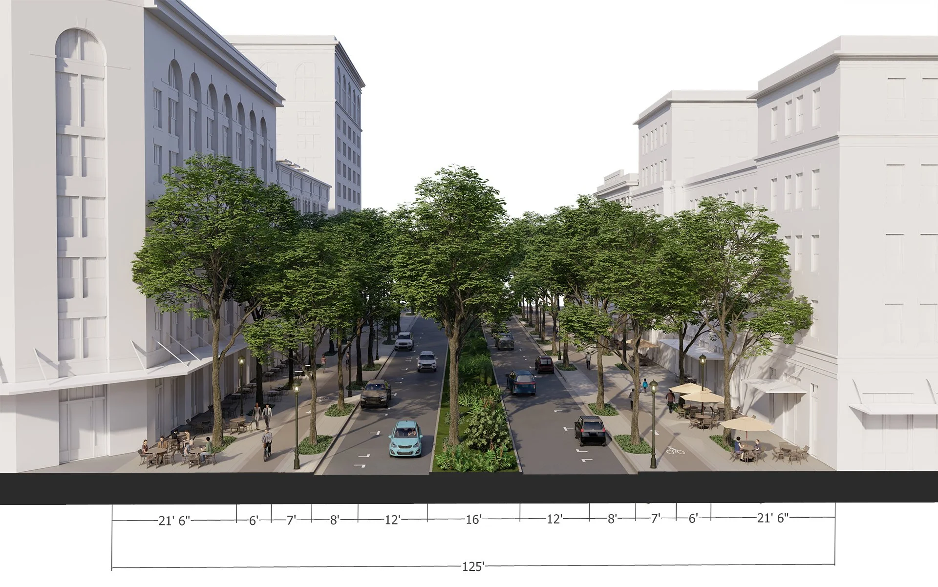
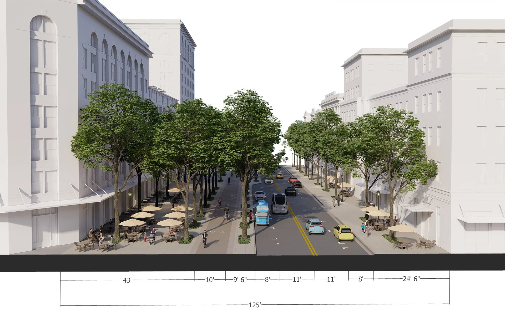
From January 9 – 13, 2023 a team of urban designers and town planners from Dover, Kohl & Partners worked on-site in Downtown Chattanooga gathering input, creating visualizations, and testing design ideas for Reimagining Broad Street. Centered on the themes of safer, greener, and livelier, three draft options emerged highlighting possibilities for the future of Broad Street.  Each option reduces the amount of space used for moving and storing automobiles, while presenting a range of options for enhancing the pedestrian space. 


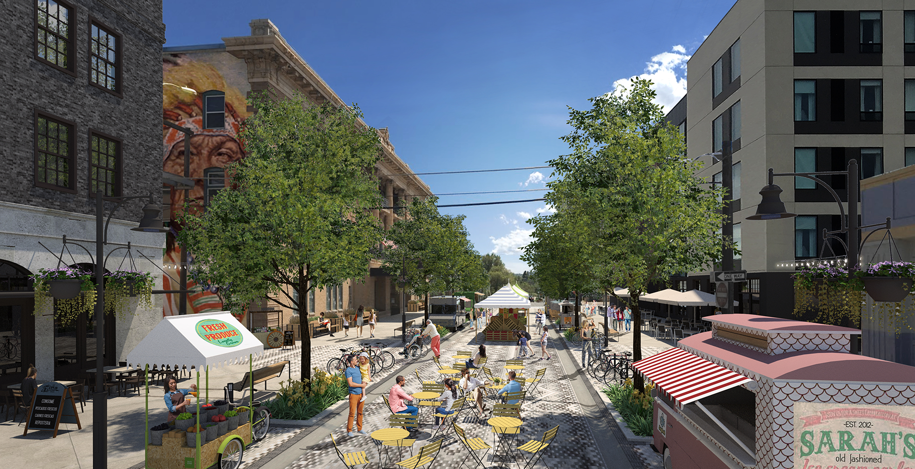
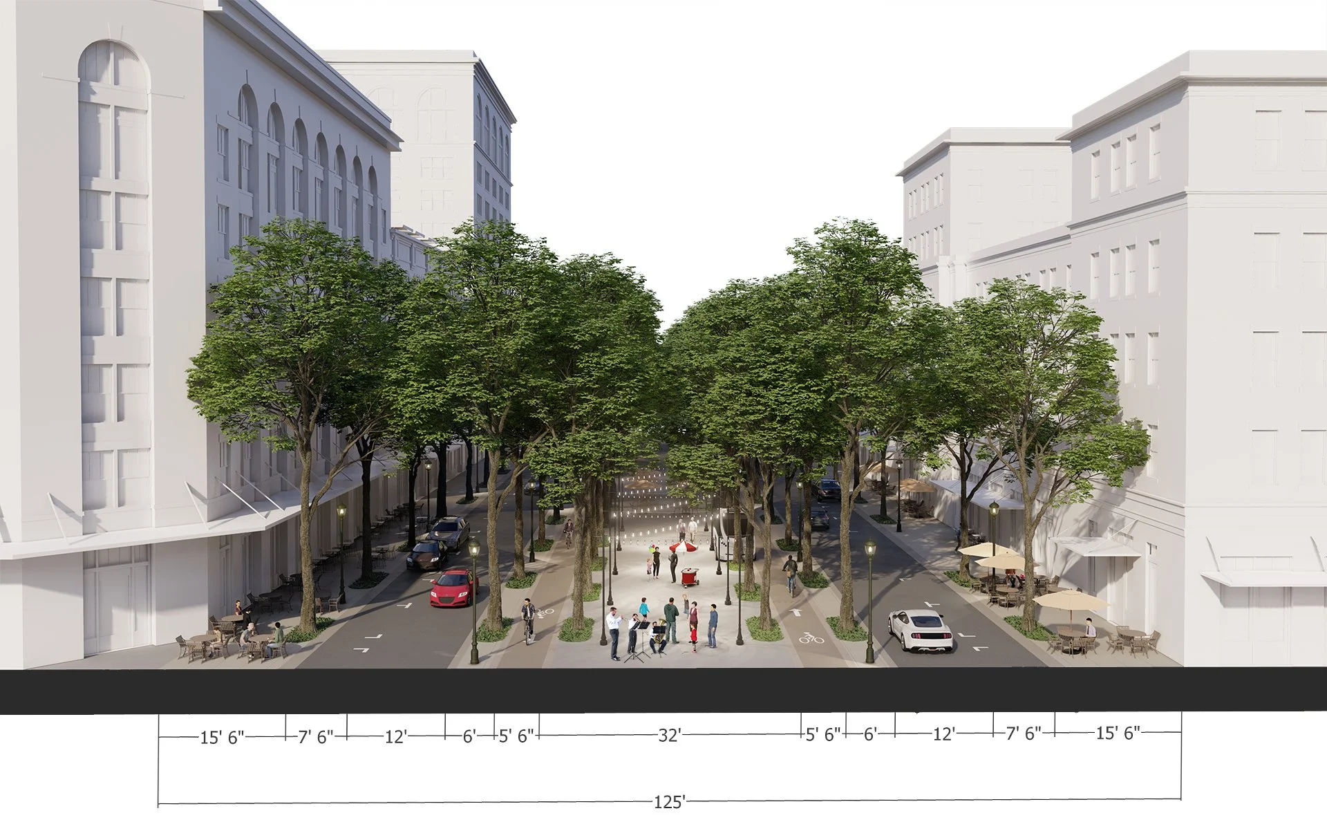
Option A features a Promenade Street where much of the walking space is in the center of the street, down a shaded allée of trees, as seen in Las Ramblas in Barcelona.  Option B features an opportunity to recapture the pedestrian-realm by right sizing the number of vehicle travel lanes and parking spaces, resulting in Broad(er) Sidewalks flanking both sides of the street.  The centerpiece of Option C, a Park Street, features moving cars all to one side of the street, allowing for the super-sizing of the sidewalk on one side of the street and the preservation of existing trees. 


Dover, Kohl & Partners is proud to partner with River City Company, Chattanooga Design Studio, and the City of Chattanooga on this important project. 


Want to learn more about the possibilities for transforming a wide, auto-oriented street into a pedestrian-friendly great street?  Visit broadstreetcha.com.

Broad Street, Existing Conditions.

Broad Street, Option A: Promenade Street

Broad Street, Option B: Broader Sidewalks

Broad Street, Option C: Park Street

DK&P Chats with WUTC About the Future of Broad Street

“Every city is looking at rebalancing the relationship from motoring and all the other things we do in a public space, like walking, biking, using transit, or just having a great address for your business or your home.” – Victor Dover, Principal, Dover, Kohl & Partners

Downtown Chattanooga is shifting the focus of its most important street from auto-oriented to more pedestrian-friendly. Listen in as the team from River City Company and Dover, Kohl & Partners chat with Ray Bassett of WUTC’s Scenic Roots about the transformation of this premier public space.

Could Broad Street become a park with a street running through it?  Is there a way to shift the amount of space dedicated to moving and storing vehicles to a more pedestrian oriented space, with wider sidewalks, street trees that provide shade and beauty, and safer cycling options?  The time is now to figure out, what’s next?  What should this street be?

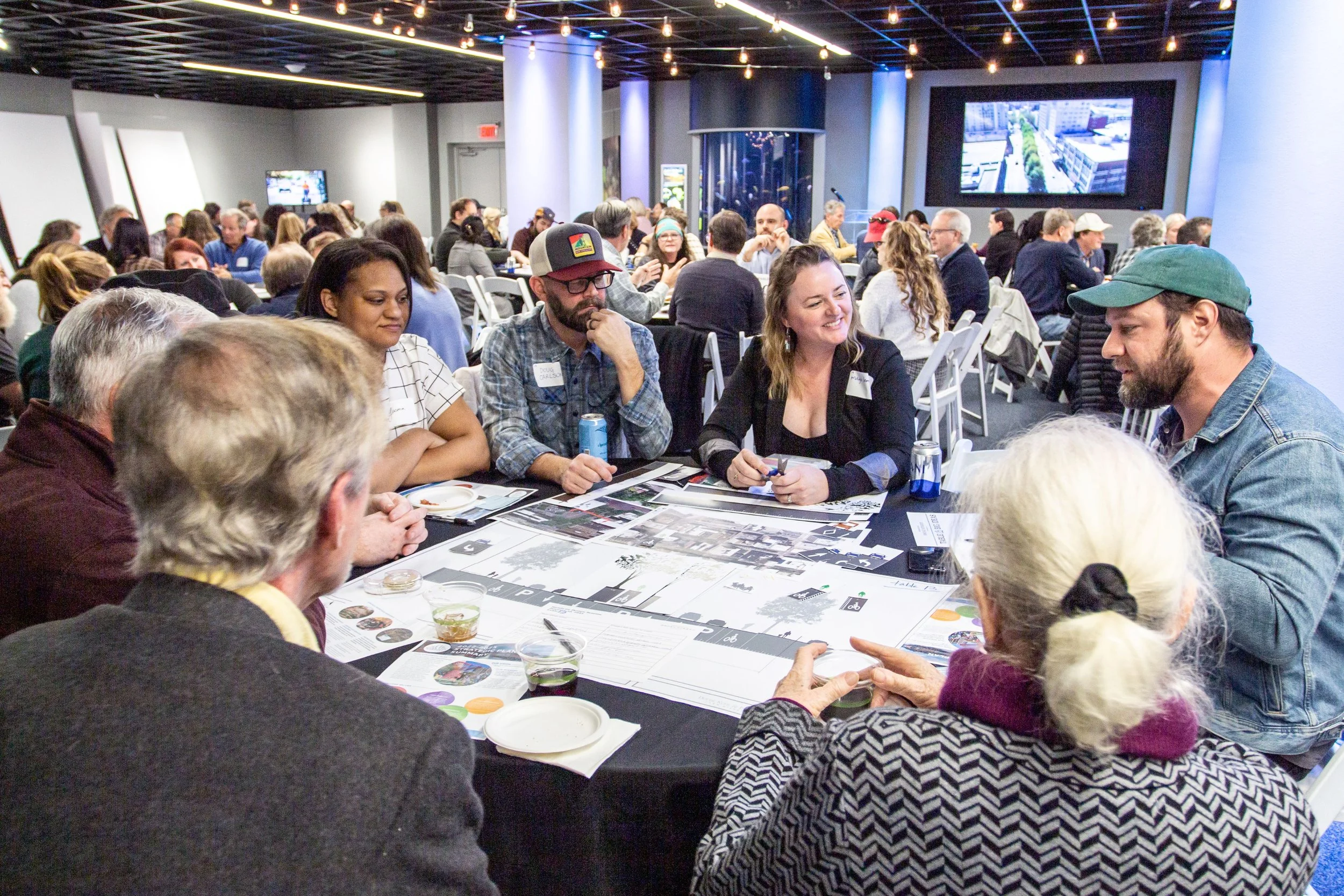
On January 10, 2023 over 150 community members gathered at the Tennessee Aquarium, working in small groups, sharing ideas for the future of Broad Street, and designing the street together.  It was an evening marked with civic enthusiasm and pride. “For me, it was a confirmation that Broad Street is as important as I thought it was to the people in Chattanooga, it looks to me… like the most important street in the region, and yet an unfinished work-in-progress,” explained Victor Dover.

Reimagining Broad Street is the direct result of community input, technical analysis, and visualizing change.  Emily Mack, President and CEO of River City Company shared that “this initiative was something that our community articulated, that they really wanted to see a more active, thriving, robust Broad Street.”

For more information, visit broadstreetcha.com.